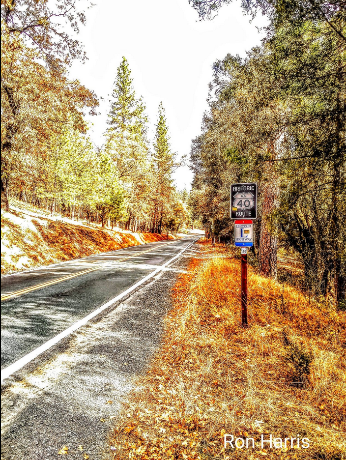
Ron Harris Photography will sometimes include photos of the Lincoln Highway. Here is one of “The Highway” near Applegate, California. In 1927 the Lincoln Highway became Highway 40 in this part of California. This stretch of road between Auburn and Baxter is a premiere “back road experience” road trip. You can follow our signs or our interactive map online here.
This post is the first of what we hope will be one of many that show how people today are helping us to remember the Lincoln Highway. Suppose you’re an active member who does this kind of work in your neck of the woods; let us know. Send some photos and a story, and we might publish it here. Leave a comment at the end of the post so we can connect.
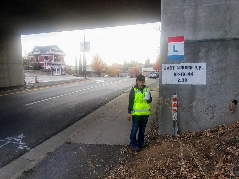
The following is a project that my wife Monica and I completed in our area in California.
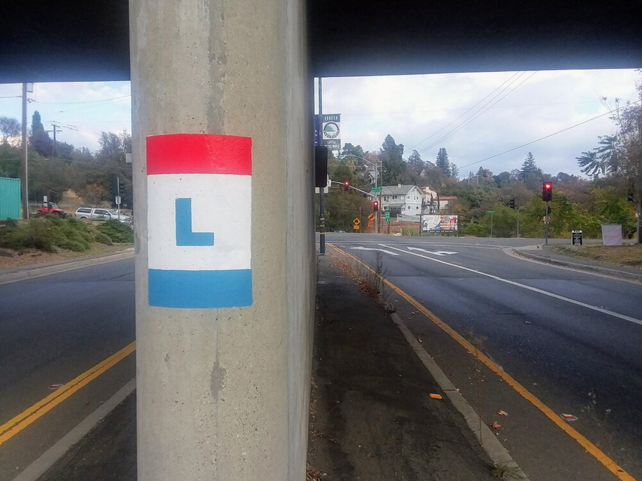
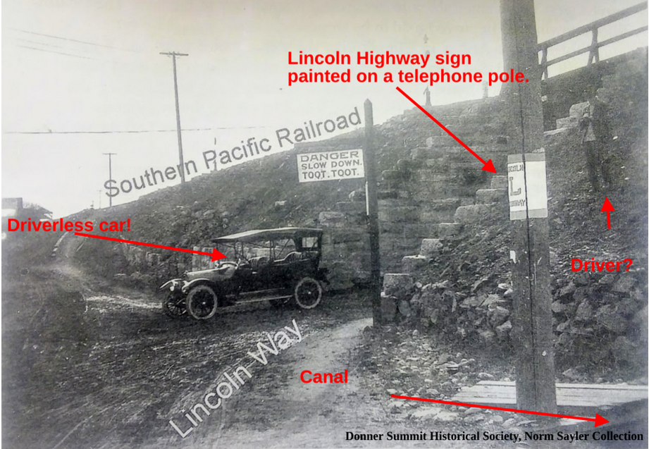
The bridge is newer, but there has been a railroad over-crossing at El Dorado Road and Highway 49/193 in Auburn since 1905! Monica and I spent part of Tuesday painting the Lincoln Highway “L” on both ends of the span. The California Chapter of The Lincoln Highway Association (CLHA) uses signs and these stencils to mark the path of the old road, just as the sign painting crews did it from 1914 to 1928.
The CLHA has recently painted other railroads over-crossings, including the 1910 Newcastle tunnel on Old State Highway, two crossings in Applegate, one at Heather Glen, Weimar, Secret Town, and the South Yuba Bridge at Cisco Grove, and finally one at Donner Summit. The Stenciled “L’s” goes along with our Historic Lincoln Highway signs you will notice along the old road. Be sure to check them out when you drive by.
The photo above is looking east. We painted two logos on this side of the bridge.
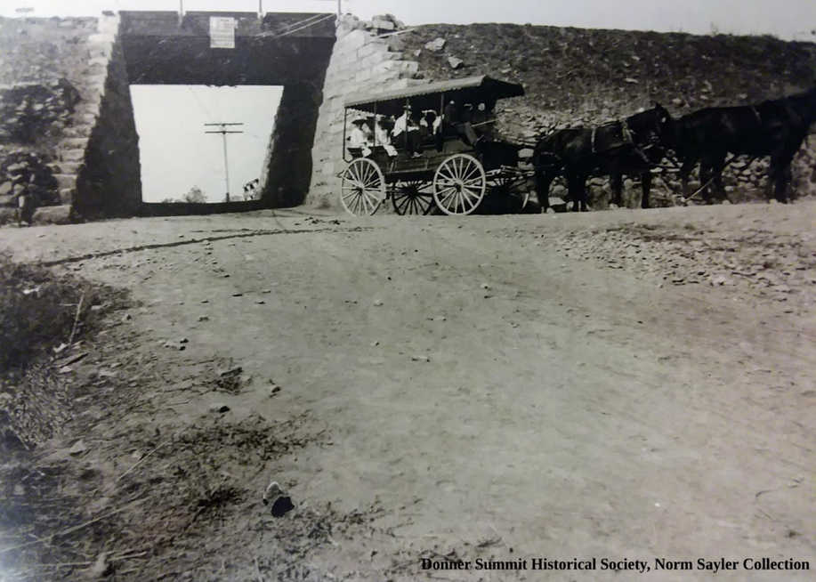
The picture above shows the same underpass but looking north from the west side.
“DANGER SLOW DOWN. TOOT. TOOT.â€
How can you find and follow the Lincoln Highway? Besides the signs and stencils, the Lincoln Highway Association publishes a Google interactive map showing the route across the country. Just keep zooming in until you are at a level that’s easy to follow. You can find the map here.
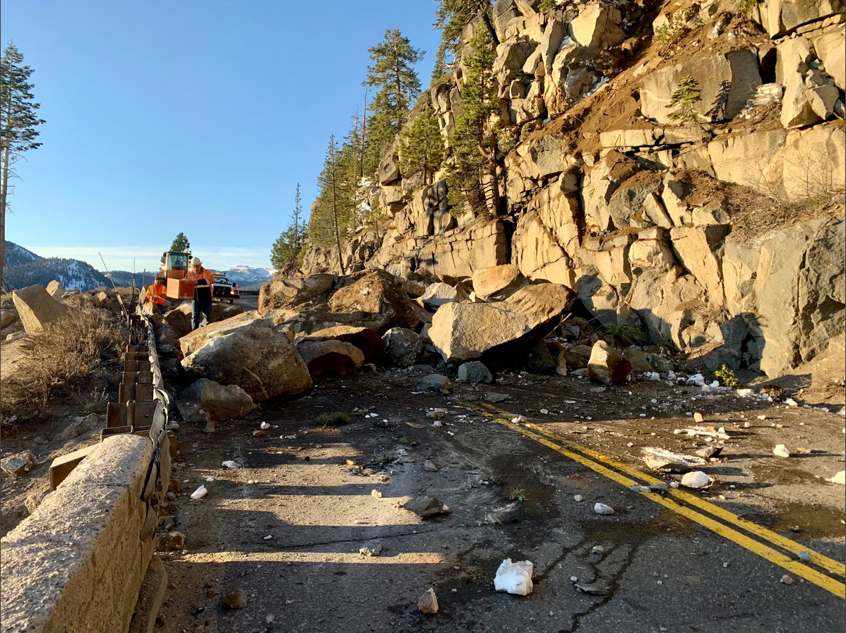
There was a rock slide at Echo Summit, along the southern or Pioneer Route of the Lincoln Highway. The rock slide occurred on a section of Highway 50 built after the route over the summit was re-routed from Johnson’s Pass in the 1930s.
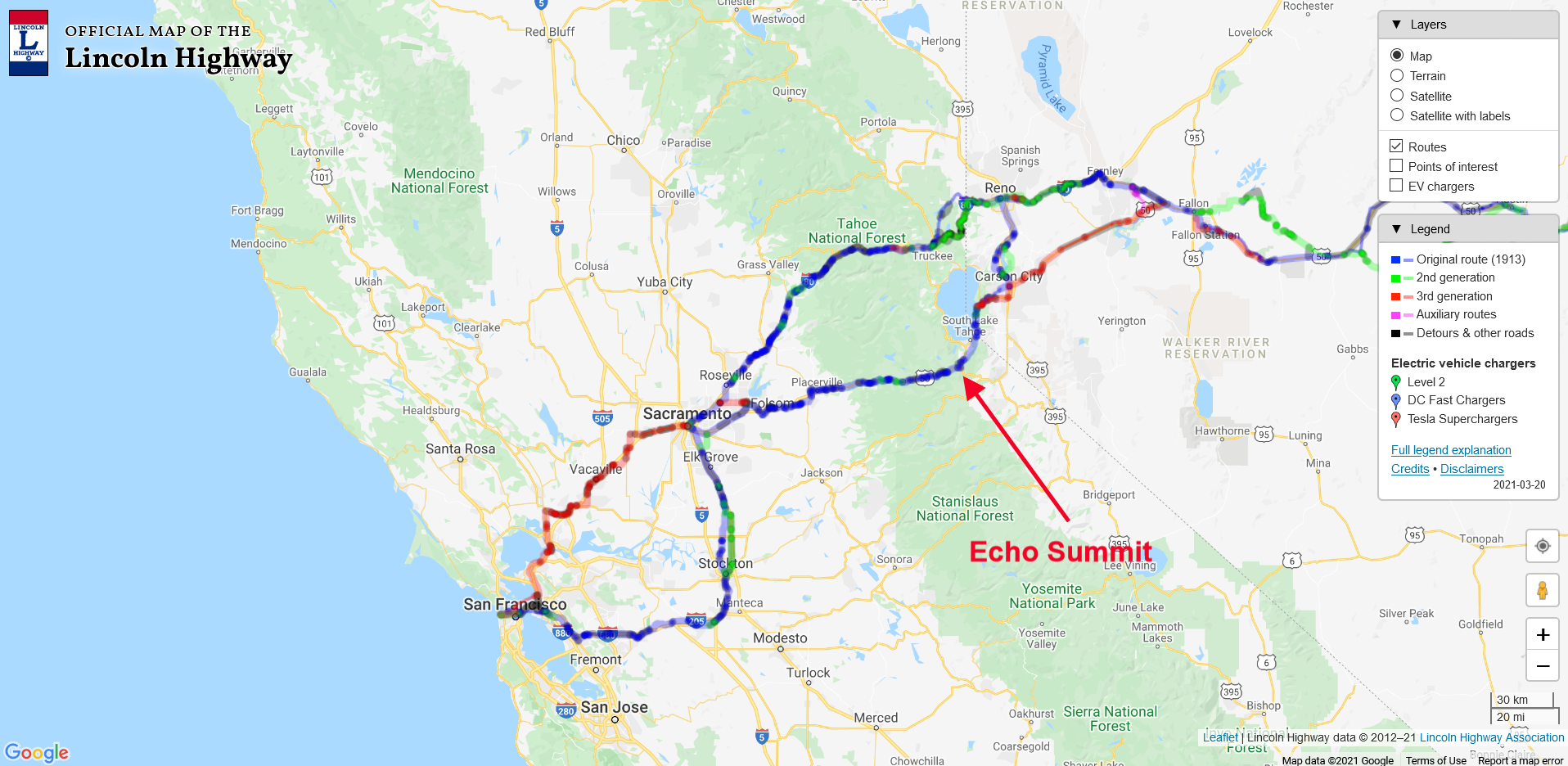
Using our interactive Lincoln Highway map, we have zoomed in to see California and the state’s two routes below. The Northern or Scenic Route crossed The Sierra at Donner Pass, while the southern or Pioneer Route crosses the Sierra at Echo Summit. The red arrow points out the site of the rock slide.
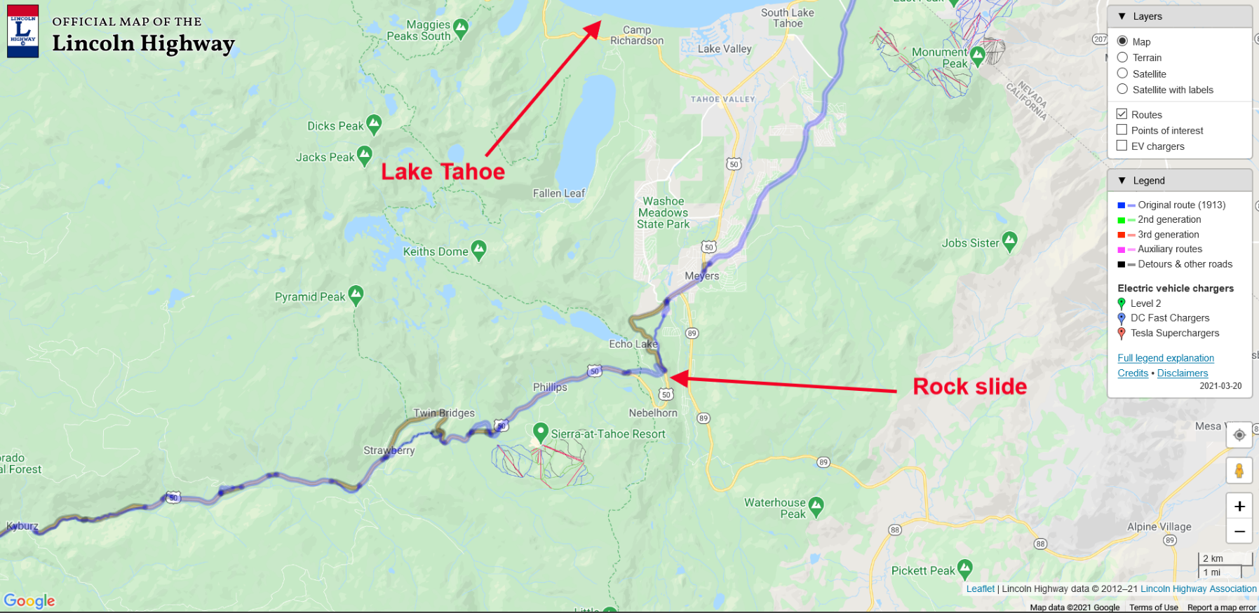
Let’s zoom in on the map for a closer look. We can see the blue line, which represents the original 1913 Lincoln Highway. Lake Tahoe is to the north, while the rock slide at Echo Summit is shown with the second arrow.
Now let’s zoom in even further and using the “Layers” drop-down at the upper right and toggle to the satellite view. Below is the map with an even closer view and toggled to the satellite feature. Here we can see the historic Johnson’s Pass on the old Lincoln Highway. The current route over Echo Summit has Highway 50 making a loop around Johnson’s Pass, thus avoiding some very steep climbs and tight turns.
Johnson’s Pass on the Lincoln Highway is still drivable once the snow melts. During the winter, Johnson’s Pass Road is snowbound. Now and then, when something happens on the current Highway 50, people are still re-routed over the old pass.
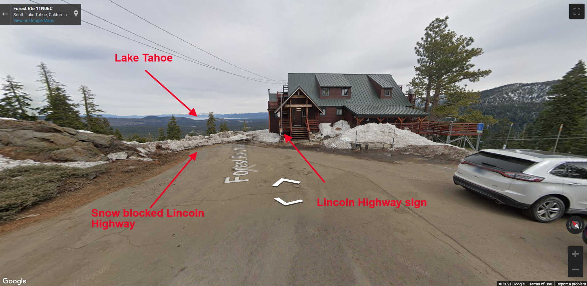
In the photograph below, we see the summit at Johnson’s Pass. That’s the Alpine Club building straight ahead, with a Lincoln Highway sign attached to the building. You can also see the snow blocked route down towards Lake Tahoe. To enable a street view from our map, drag the “street view icon” to a spot on the map and drop it. The street view will materialize like in the photo below.
The Lincoln Highway interactive map shows the entire route of the Lincoln Highway across the country. You can zoom in on any area and start exploring from the comfort of your home, or while driving along the old highway.
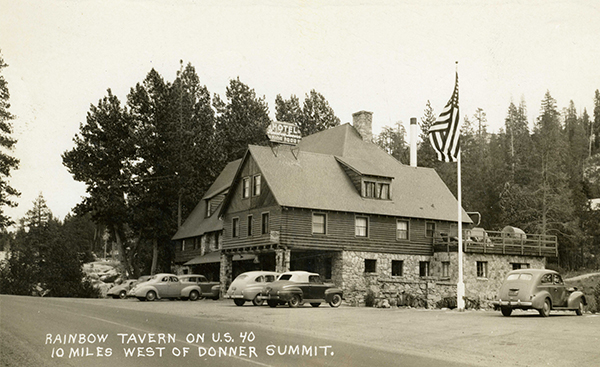
The California Chapter of the Lincoln Highway Association will hold our summer meeting at the beautifully historic Rainbow Lodge on the old Lincoln Highway in the scenic Sierra Nevada Mountains. The chapter has rented the lodge for the day!
The lodge, originally called the Rainbow Tavern and Trout Farm, was built in 1927 and opened to the traveling public all year round. It is nestled in the forest of the Sierra Nevadas on a scenic portion of the Lincoln Highway, overlooking the Yuba River.
We will have a barbecue lunch out in the back patio with a view of the river, and hold the meeting and presentation inside in the Presentation Room after lunch.
We are limited to fifty (50) participants, so to attend, you will need to mail a payment for $35 per person, postmarked by June 14. The fee covers the lunch and a share of the lodge rental cost for the day.
Schedule
10:00 am — Meet and greet
Enjoy the beautiful Sierra Nevada surroundings and the historic Rainbow Lodge itself.
11:30 am — Barbecue lunch
Served on the deck (or in Yuba Room if weather does not allow outdoor seating)
Menu:
Beef hamburgers served with all the fixings, including lettuce, tomato, pickles, onions and cheese, served with potato chips
Knockwurst and bratwurst
Veggie burgers (must be requested in advance)
Homemade potato salad and cole slaw
Fresh watermelon for dessert
Sodas, coffee, tea
No liquor or beer will be served
1:00 pm — Meeting
3:00 pm — Presentation
Donner History Along the Lincoln Highway
Reservations
This meeting will be popular, so reserve your spot as soon as possible. Please mail the following information:
Names of each participant in your party
Mailing address
Phone number
Email address
Whether you want a veggie burger instead of a hamburger
A check payable to Lincoln Highway California Chapter, in the amount of $35 for each participant in your party
Mail info and checks postmarked by June 14, 2019 to:
Lincoln Highway California Chapter 1136 Capri Drive Campbell, CA 95008-6007
Rainbow Lodge History by the Donner Summit Historical Society
Rainbow Tavern, as it was then known, was built in 1927 by Herstle Jones who also built Nyack Lodge. He was the brother of Oscar Jones who built the Soda Springs Hotel. Rainbow Lodge served as a way stop for summer travelers over the Sierra Nevada mountains offering meals, rooms, and cabins as well as a trout farm. Visitors could catch their fish and have the dining hall prepare them for supper. Once Old Highway 40 (the Lincoln Highway) was plowed in the winter, Rainbow Tavern became a winter destination and way station as well. A rope tow was built out back and skiers were welcomed. Later, skiers who were more adventurous were taken up to the Sugar Bowl ski area. There were also two gas stations located at the Rainbow Tavern for needy travelers.